

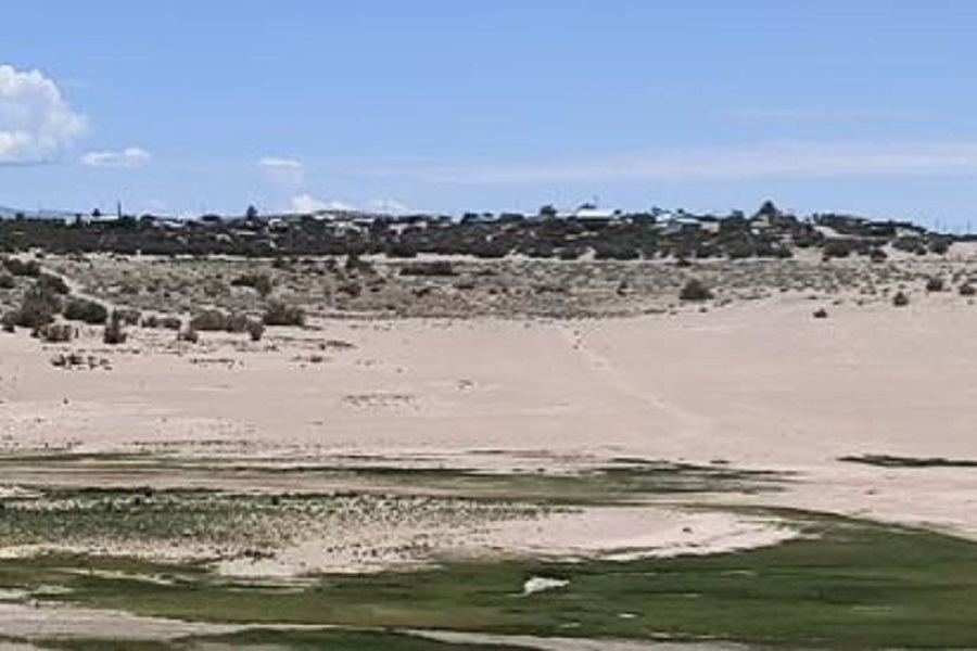
Elephant Butte, New Mexico’s largest reservoir, has been reduced to a fraction of its former self, plunging to its lowest level since 1971, or 1.4 percent of capacity in late July, exposing the submerged debris and leaving sediment clogging boat ramps.
The crisis at Elephant Butte is not only about a shrinking lake. It is the most recent warning for Rio Grande’s river system, which has sustained farms, communities, and entire economies across southern New Mexico and Texas for centuries.
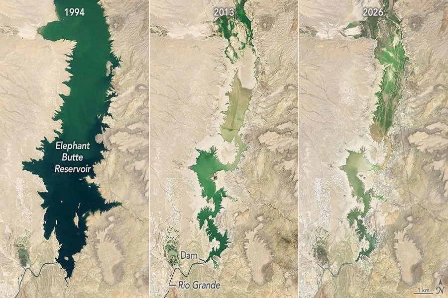
A satellite image of Elephant Butte on July 27, 2026, showed the reservoir held just 1.4 percent of its capacity. The number marked an astonishing decline from the reservoir’s early days.
In June 1994, the lake was nearly full. And for much of the period between 1985 and 2000, the water levels also remained relatively high. Even during another punishing drought in 2013, Elephant Butte reached an annual low of 2.9 percent capacity, more than twice the level recorded this summer.
Situation Got Worse After a Record Snowmelt
The latest drop in the lake’s water level follows years of persistent, extreme drought across the Rio Grande basin. And 2026 delivered another devastating blow.
Southern Rocky Mountains’ river headwaters experienced the earliest snowmelt on record, according to drought and water-monitoring data. That meant the mountain snowpack, the critical source of water for the Rio Grande, disappeared early.
Combined with the prolonged drought in the basin, the early snowmelt had placed greater pressure on an already depleted water system, as evidenced at Elephant Butte, where the receding water exposed debris that had remained hidden beneath the lake for years.
The sediment also covered the boat ramps at Elephant Butte Lake State Park as the shoreline receded. However, there was a sign of relief, no matter how small.
State officials said agricultural water releases ended after July 28. That allows the reservoir to begin rising slowly again. But the modest reprieve does little to alleviate the broader concerns about the future of water in the Rio Grande Valley.
A Green Oasis in the Desert
In 1962, astronaut John Glenn orbited Earth. He spotted a striking green valley surrounded by a massive arid landscape in the northwest of El Paso, and it was no accident.
Human-made lakes and irrigation systems along the Rio Grande had helped the valley become an agricultural oasis. The farmers have depended on the river’s water to grow crops, such as alfalfa, cotton, onions, and pecans, including New Mexico’s world-famous Hatch green chiles.
But that green ribbon cutting through the desert has been under increasing pressure. Communities and farmers in both New Mexico and Texas depend on the complex combination of surface water and groundwater.
Officials are facing difficult decisions about how much water to store, release, pump, and share as drought intensifies and reservoirs shrink.
NASA is Watching
Amid Rio Grande’s dwindling water supplies, scientists are turning to satellites for help. NASA’s Water Action Office supported several projects that used space-based observations and advanced analytical tools to give water managers a clearer picture of what is happening above and below ground.
One project developed a near-real-time model that combines satellite measurements of soil moisture and evapotranspiration, a process by which water moves from land and plants back into the atmosphere. The system aims to supplement existing water allocation methods used by the Elephant Butte Irrigation District.
Another project combined satellite measurements of water surface height with drone observations and ground-based instruments. The researchers used the data to study how groundwater pumping can affect the flow of the Rio Grande. That information could be important for water officials, who attempt to manage competing water demands and enforce water rights.
In the meantime, Elephant Butte appears to have reached rock bottom in July. But with the reservoir sitting at just a fraction of its capacity, the images from New Mexico offer a stark reminder of how fleeting a water lifeline can be.
More than six decades after John Glenn looked down from space and marveled at a green valley cutting through the desert. And the water that made that green oasis possible is running dangerously low.